Our goal:
Simulation-ready in < 2 min
Create, correct and connect hydraulic networks, saving multiple hours to days of manual work with our automated preparation tools.
Less time spent on the data preparation phase means more time for you and your team to focus on simulation, project development, and your customers.
That is why Kankyo can save ∼30% of project costs.
Catchment
Generation & Connection
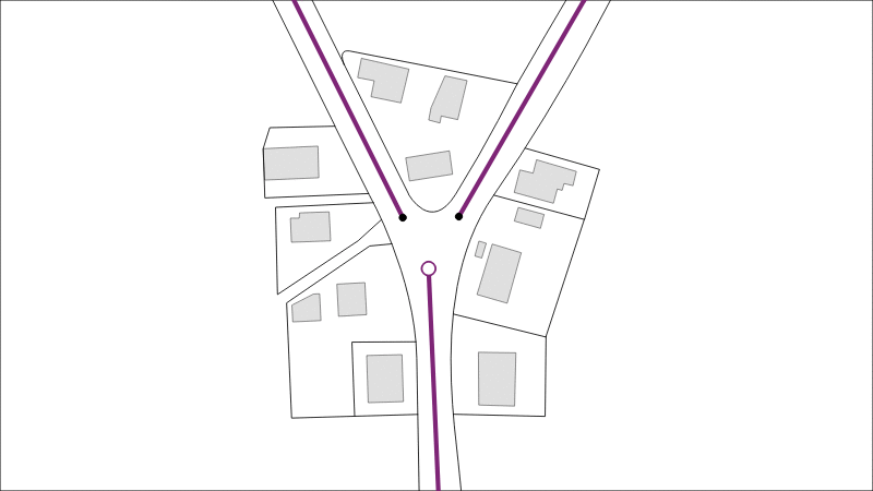
Kankyo automatically creates and connects your catchments with >90% accuracy, as good as an expert.
With clear reporting at every stage, Kankyo highlights potential issues in the data and gives you the tools you need to make corrections.
Instant Data Clean-Up
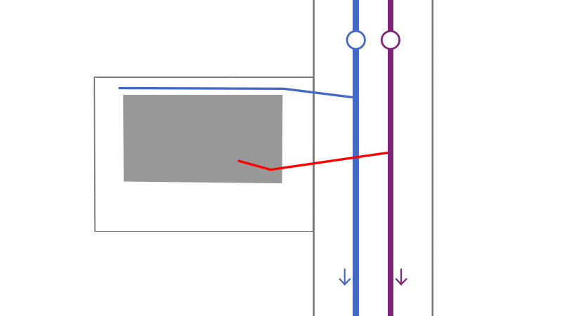
Kankyo scans your asset database for missing essential data and hidden inconsistencies in a way that goes beyond standard checks. It repairs them instantly, whilst providing full transparency of the changes made and highlighting the potential need for additional measurements.
Improving the status quo is just the beginning. We are planning features that aim to drastically reduce time spent correcting data. Let us know in our survey which features would help you the most.
Your hydraulic simulations demand accuracy, and so do we.
Gaps in the network?
Ensure network connectivity with Kankyo.
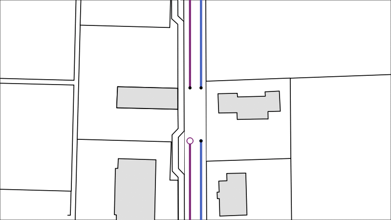
Kankyo automatically detects and closes gaps in the hydraulic network data, whilst taking special structures into account.
Coming Soon...
Discover features in active development.
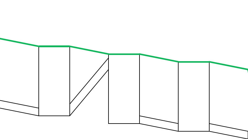
3D Special Structures,
including Water Levels
For efficient database entry of special structures and their hydraulic behaviour, technical drawings are translated to
3D objects and respective water levels are calculated and displayed immediately. The process gives you control at every step with manual editing, leaving your structures ready for direct import into your simulation software in just a few clicks.
Validation Rainfall:
Any Time, Any Place
Plus, if you already have your local measurements,
we can take those too.
Post-processing and Results
Are hospitals or other critical infrastructure affected? How often does a specific object reach critical water levels in 10 years? Which measures variant is the most effective? Extract all important insights from the simulation with just a few clicks and compare various states instantly using visual overlay.
Our Current Features:
Catchments
Generation
Automated generation of catchment areas with full data set (area, runoff coefficient, number of people, drainage system, etc.)
Connection
Our algorithm automatically detects which pipe network the catchment should be hydraulically connected to, including usage type and load type.
Automation
Our Catchment Connection tool works with an accuracy of over 90%.
It takes into account building zones and ground height, intersects roads, identifies drainage systems, calculates runoff coefficients, and much more.
Network
Network Connectivity
Detection and closing of gaps in the drainage network with recognition of special and unusual structures.
Data Clean-Up
Provision and cleaning of essential attributes in the asset data, as well as removal of redundant objects. Flagging of data points where measurements would be beneficial.
Custom Editing
If you still want to edit something, you can do it more efficiently with our intuitive and transparent Map Editor.
Data Management
Data Model Translator
Import and export in any data model and data format. Regardless of canton or registry office.
Direct Import to Simulation Software
Import / export interface to simulation software (DHI Mike+, InfoWorks, etc.) enables swift and easy setup of your simulation model.
Infinite Versioning
Thanks to automatic and object-specific versioning, all changes remain traceable and can be visualised directly in the editor. Now data loss will be a thing of the past.
Technologies